
 Resources
 Campus Life
 Just for you


 My Canyons
  Canvas
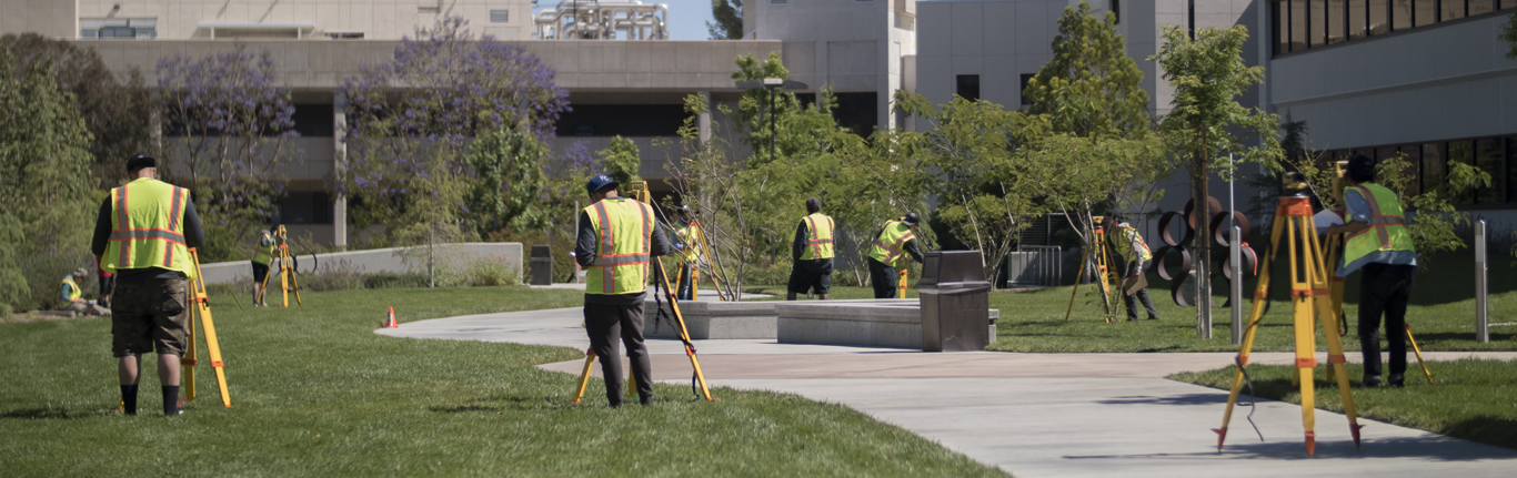
Course Descriptions
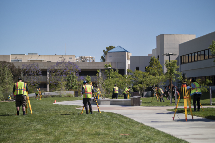
SURV 101A INTRODUCTION TO LAND SURVEYING
3 units | 54 hours lecture
Recommended concurrent enrollment in SURV-101L
Presents the fundamentals of land surveying theory and calculations. Includes equipment, horizontal, vertical, and angular measurements, errors, traversing, leveling, and stadia. Also covers the history of and careers in surveying.
SURV 101L INTRODUCTION TO LAND SURVEYING LABORATORY
1 unit | 54 hours lab
Completion of or concurrent enrollment in SURV-101A
Presents the fundamentals of land surveying field practice and equipment use. Includes horizontal, vertical, and angular measurements, errors, traversing, leveling, and stadia.
SURV 102A ADVANCED LAND SURVEYING
3 units | 54 hours lecture
Prerequisite: SURV-101A Recommended Preparation: MATH-102
Recommended concurrent enrollment in SURV-102L
Presents advanced concepts in land surveying theory and calculations. Includes equipment, horizontal and vertical curves, construction staking, earthwork, topography, public lands, and state plane coordinates.
SURV 102L ADVANCED LAND SURVEYING LABORATORY
1 unit | 54 hours lab
Prerequisite: SURV-101A and SURV-101L
Completion of or concurrent enrollment in SURV-102A
Presents advanced concepts in land surveying field practices and equipment use. Includes horizontal and vertical curves, construction staking, and topography.
SURV 103 ADVANCED APPLICATIONS IN SURVEYING I
3 units | 54 hours lecture
Prerequisite: SURV-101A
Focuses on measurement analysis and adjustments, geodesy, various mapping elements, state plane coordinates and the use of GPS for land surveying
applications.
SURV 104 ADVANCED APPLICATIONS IN SURVEYING II
3 units | 54 hours lecture
Prerequisite: SURV-101A
Presents photogrammetry and celestial surveying, emphasizing concepts and calculations performed by the land surveyor, including horizontal and vertical
curves.
SURV 110 COMPUTER-AIDED DRAFTING FOR SURVEYORS
3 units | 36 hours lecture, 54 hours lab
Recommended Preparation: SURV-101A
Introduction to computer-aided drafting for land surveying using AutoCAD Civil 3D.
SURV 260 BOUNDARY CONTROL AND LEGAL PRINCIPLES I
3 units | 54 hours lecture
Recommended Preparation: SURV-102A
Introduces the basic elements of the U.S. Public Land Survey System (PLSS), including background, history, subdivisions of sections, and resoration of lost corners. Principles of preparing land descriptions for surveyors and title companies.
SURV 265 BOUNDARY CONTROL AND LEGAL PRINCIPLES II
3 units | 54 hours lecture
Recommended Preparation: SURV-260
Examines principles of boundary control, including land descriptions, property transfer, senior rights, conveyances, and case law pertaining to boundary
disputes.

GNSS Non-Credit Courses
- NC.SURV 010 - Principles of GNSS Technology: Presents an overview of the components of the Global Navigation Satellite System (GNSS) system, including: the GNSS satellite constellations, their signal structure; GNSS orbits and tracking networks; GNSS measurements and their properties and error characteristics; absolute and differential positioning; GNSS receivers, their capabilities and limitations, and selecting the proper technique for a specific application.
- NC.SURV 015 - Fundamentals of Geodesy: Provides an overview of geodesy, examines the fundamental goal of geodesy, and introduces those geodetic concepts useful in better understanding GNSS. Topics include geodetic datums and reference systems, satellite geodesy, geodetic quantities and transformation of terrestrial positions.
- NC.SURV 020 - GNSS Leveling: Introduces the concepts and techniques involved in establishing precise ellipsoidal heights and the application of a geoid model to derive orthometric heights. Topics include fundamental relationships between heights, practical representation and use of regional and global geoid models, local geoid modeling by surface-fitting, network design, and observing procedures for recovering high-accuracy orthometric heights. Accuracy and limitations of the method are also explored.
- NC.SURV 025 - Survey Data Adjustments: Examines the types of errors encountered in survey data and the appropriate data adjustment methods. Familiarity with common least squares adjustment software and reports will be achieved.
- NC.SURV 030 - GNSS Techniques: Examines the near-real-time solutions available from Differential GNSS (DGNSS), Real-Time Kinematic (RTK) and Networked RTK as well as state-of-the-art control survey accuracies with advanced post-processing techniques using a global network of continuous tracking GNSS sites.
- NC.SURV 035 - Map Projections: Focuses on the methods and procedures required for accurately mapping or projecting positions measured in a three dimensional world on to a flat two dimensional surface using computer software. Topics include the history and geometry of map projections, regulatory compliance, and coordinate conversions.
- NC.SURV 040 - Control Surveys Using GNSS: Examines the process of conducting a control survey using GNSS technologies including planning, field measurements, data processing, adjusting, and analysis of the final results. Organizational design and observation planning is needed to meet stringent control survey standards and specifications. GNSS Surveying Standards and Specifications 1.1 by CLSA & CSRC and Specifications for Geodetic Control Networks and Geometric Accuracy Standards are also addressed.
- NC.SURV 045 - GNSS Processing and Analysis: Explores GNSS data collection and processing, and the analysis and evaluation required to deliver practical surveying and mapping information. Participants work in small groups to perform GNSS surveys where data is collected in the field, downloaded, processed, analyzed, and evaluated.