
 Resources
 Campus Life
 Just for you


 My Canyons
  Canvas
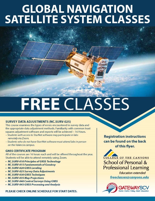
Land Surveying

Course and Certificate Information For Free Classes
Certificate of Completion: Global Navigation Satellite System (GNSS) Certificate Program
GNSS technology has become a Land Surveying industry standard and there is an increasing need for Land Surveyors with GNSS technology skills. This program will provide students with a fundamental understanding of GNSS technology, Geodesy, field techniques and applications, GNSS data adjustments, processing, and analysis, and map projections. The purpose of the program is to provide both current surveyors and those new to the profession the skills and knowledge needed to conduct and process surveying projects in the workplace using GNSS technology.
- NC.SURV 010 PRINCIPLES OF GNSS TECHNOLOGY: 16.00 hours Presents an overview of the components of the Global Navigation Satellite System (GNSS) system, including: the GNSS satellite constellations, their signal structure; GNSS orbits and tracking networks; GNSS measurements and their properties and error characteristics; absolute and differential positioning; GNSS receivers, their capabilities and limitations, and selecting the proper technique for a specific application.
- NC.SURV 015 FUNDAMENTALS OF GEODESY: 16.00 hours Provides an overview of geodesy, examines the fundamental goal of geodesy, and introduces those geodetic concepts useful in better understanding GNSS. Topics include geodetic datums and reference systems, satellite geodesy, geodetic quantities and transformation of terrestrial positions.
- NC.SURV 020 GNSS LEVELING: 16.00 hours Introduces the concepts and techniques involved in establishing precise ellipsoidal heights and the application of a geoid model to derive orthometric heights. Topics include fundamental relationships between heights, practical representation and use of regional and global geoid models, local geoid modeling by surface-fitting, network design, and observing procedures for recovering high-accuracy orthometric heights. Accuracy and limitations of the method are also explored.
- NC.SURV 025 SURVEY DATA ADJUSTMENTS: 16.00 hours Examines the types of errors encountered in survey data and the appropriate data adjustment methods. Familiarity with common least squares adjustment software and reports will be achieved.
- NC.SURV 030 GNSS TECHNIQUES: 16.00 hours Examines the near-real-time solutions available from Differential GNSS (DGNSS), Real-Time Kinematic (RTK) and Networked RTK as well as state-of-the-art control survey accuracies with advanced post-processing techniques using a global network of continuous tracking GNSS sites.
- NC.SURV 035 MAP PROJECTIONS: 16.00 hours Focuses on the methods and procedures required for accurately mapping or projecting positions measured in a three dimensional world on to a flat two dimensional surface using computer software. Topics include the history and geometry of map projections, regulatory compliance, and coordinate conversions.
- NC.SURV 040 CONTROL SURVEYS USING GNSS: 16.00 hours Examines the process of conducting a control survey using GNSS technologies including planning, field measurements, data processing, adjusting, and analysis of the final results. Organizational design and observation planning is needed to meet stringent control survey standards and specifications. GNSS Surveying Standards and Specifications 1.1 by CLSA & CSRC and Specifications for Geodetic Control Networks and Geometric Accuracy Standards are also addressed.
- NC.SURV 045 GNSS PROCESSING AND ANALYSIS: 16.00 hours Explores GNSS data collection and processing, and the analysis and evaluation required to deliver practical surveying and mapping information. Participants work in small groups to perform GNSS surveys where data is collected in the field, downloaded, processed, analyzed, and evaluated.
Registration Instructions
To register for these courses, you must be an existing student or apply to be a student at the college.
For Questions Call 661-362-3304 or email PPL@canyons.edu